
Northeast Ocean Data Portal – Providing a Common Picture of New England’s Ocean Uses
The North Atlantic ocean is a busy place, full of sea life, ships, and – fortunately – a slew of data. Anyone interested in local, state, or regional marine planning efforts in New England can visit the Northeast Ocean Data portal (http://www.northeastoceandata.org/), which provides ocean-related maps and data to the public. The Northeast Ocean Data portal directly supports the Northeast Regional Planning Body, which is responsible for developing the ocean plan for New England with representation from states, federally recognized tribes, federal agencies, and the New England Fishery Management Council. The Northeast Ocean Data portal relies on open data from multiple federal and state partners to provide comprehensive information about ocean conditions and ocean uses.
The data available for download through the Northeast Ocean Data portal ranges from physical oceanographic characteristics (like shoreline classification and seafloor depth measurements) to administrative boundaries, to animal habitats and species abundance, to data on overlapping ocean uses among diverse user groups such as aquaculture, marine transportation, recreational boating/fishing, and energy production and transmission. Multiple relevant external data sources such an real-time weather forecasts can also be accessed through the portal. Users can also view, edit, and download maps on topics such as water quality, commercial fishing, energy and infrastructure, and the presence of animal groups like fish, birds, or marine mammals. Two example maps are shown below, one displays navigation-related features and the other features marine mammal abundance.
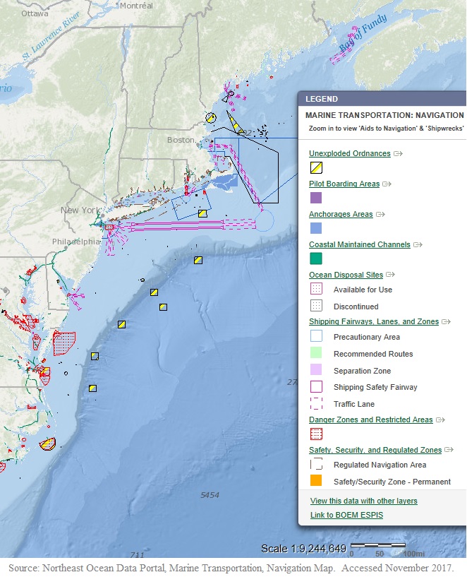
Map of navigation-related features in the northeastern U.S., including channels, shipping lanes, and restricted areas. From the Northeast Ocean Data Portal.
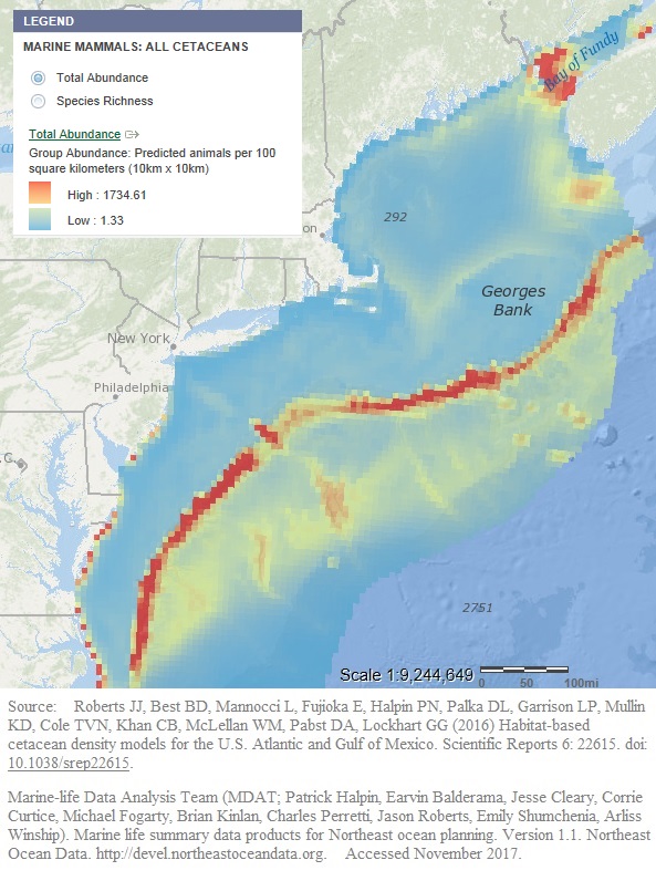
Map of marine mammal distribution areas along the U.S. Northeastern seaboard. Red colors indicate higher recorded abundance. From the Northeast Ocean Data Portal.
For information on a west coast regional data project check out the post on the California Seafloor and Coastal Mapping Program.
If you’re interested only in vessel-traffic specific information check out the post on Visualizing ocean traffic on Marine Cadastre.
By Marin Kress, Research Scientist, U.S. Army Engineer Research and Development Center
